Urban Flood Warning Station, OTT RLS, Camera
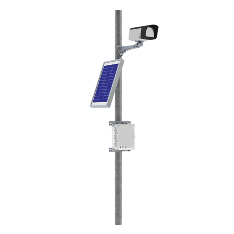
The Urban Flood Warning Station is a turn-key solution for a real-time flood warning network. This product bundle is designed to simplify the process of establishing a flood warning network in your community. Modify the station to measure additional parameters to suit your application.
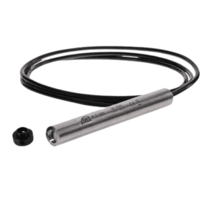
- Non-Contact Measurement: Uses 80 GHz FMCW radar to measure depth to water, unaffected by air temp, humidity, debris, or waves.
- High Accuracy: Offers precise readings (e.g., ±2 mm), meeting strict standards like USGS.
- Durability: Compact, waterproof (IP67) housing with a flat antenna design, minimizing maintenance and insect issues.
- Low Power: Optimized for remote sites, requiring minimal energy for long-term deployment.
- Easy Integration: Standard interfaces (SDI-12, Modbus RTU, 4-20mA) connect to data loggers/telemetry.
- Self-Diagnostics: Built-in QA/QC data (signal-to-noise, target count) for performance verification.
- Flood Early Warning: Detects rising water levels quickly to trigger alarms or alerts (SMS, email) for timely evacuation or preventative actions.
- Stormwater Management: Monitors drains, retention ponds, and channels to prevent urban inundation during heavy rains.
- Surface Water Monitoring: Provides reliable data for rivers, streams, and lakes within cities.
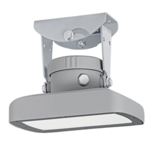
- Visual Verification: The camera adds crucial visual context, confirming sensor readings and assessing flood extent.
- Non-Contact Measurement: The radar sensor (OTT RLS) measures water level from above, avoiding fouling from debris or complex installation issues common with submerged sensors.
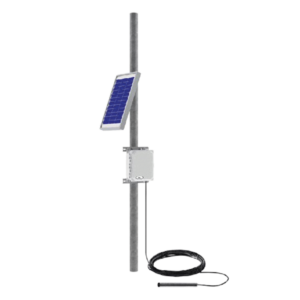
- Low Maintenance: Designed for remote, long-term deployment with robust housing and self-diagnostic features, minimizing site visits.
- Easy Integration: Connects easily with data loggers (like OTT SensorLink) and uses standard protocols (SDI-12, Modbus) for seamless data flow.
- Urban Flood Monitoring: Provides real-time data for timely warnings to protect infrastructure, roads, and vulnerable zones.
- River & Stream Gauging: Measures water levels and flow in natural and engineered channels prone to flooding.
- Stormwater Management: Monitors retention basins, culverts, and drainage networks to prevent overflow.
- Tide Monitoring: Tracks tidal fluctuations in coastal regions for early flood and surge alerts.