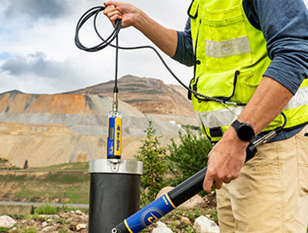
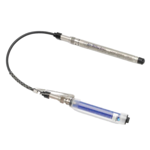
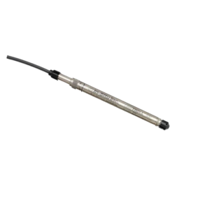
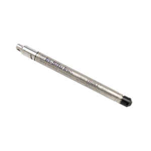
Ground Water monitoring

Groundwater monitoring plays a crucial role in managing and sustaining one of the Earth’s most vital resources. As the primary source of drinking water for billions of people worldwide and a key component of agricultural irrigation, industrial processes, and ecosystem support, groundwater must be carefully monitored to ensure its quality and availability.

Monitoring groundwater involves the systematic collection and analysis of data from wells, piezometers, and other subsurface measurement points. This data provides valuable insights into groundwater levels, quality, and flow patterns. Continuous monitoring helps identify trends, detect potential contamination, and assess the overall health of aquifers.

Read More

Related Products

Digital Water Level Recorder(DWLR)/ Piezometer/ CGWA

Ultrasonic Flowmeter for Ground Water Monitoring- Badgermeter

Level Data Logger For Ground Water Monitoring-Sommer

Groundwater monitoring is the systematic observation of underground water levels and quality to support sustainable usage, detect pollution, manage irrigation, and comply with environmental regulations. This process uses tools like observation wells, piezometers, pressure transducers, water quality probes, and IoT-enabled loggers to track trends in flow, quantity, and contamination. Techniques range from manual measurement to satellite mapping and real-time mobile-based monitoring. In India, key data sources include the Central Ground Water Board, ISRO’s Bhuvan portal, and NASA’s GRACE satellite, with live maps and regional dashboards made accessible via platforms like those offered by Aaxis Nano. Aaxis Nano integrates cutting-edge technology like ground water detectors, automated well monitoring systems, and water level check apps, enabling users—from farmers to urban planners—to access real-time groundwater level data, predict scarcity, and optimize water usage.


What Is Groundwater Monitoring?

Groundwater monitoring is the process of observing and recording changes in the quantity and quality of groundwater over time. It’s vital for:

    • Water resource planning

    • Irrigation management

    • Environmental protection

    • Pollution control

    • Urban infrastructure planning


What Are the Objectives of Groundwater Monitoring?

Understanding the objectives of groundwater monitoring helps identify why it’s essential:

    • Track seasonal and long-term groundwater trends

    • Detect contamination or over-extraction early

    • Support sustainable groundwater usage

    • Comply with environmental and governmental regulations

    • Improve water distribution strategies in agriculture and cities


How Do You Monitor Groundwater Flow?

Monitoring groundwater flow involves:

1. Installing Observation Wells

Wells are dug at specific locations to track water movement below the surface.

2. Using Piezometers

Piezometers are narrow tubes used to measure hydraulic head and flow direction.

3. Conducting Tracer Tests

These tests use chemical tracers to determine groundwater travel paths and speed.

4. Geophysical Methods

Electrical resistivity and seismic methods help visualize underground flow paths.


What Equipment Is Used for Groundwater Monitoring?

The following equipment is commonly used:

    • Ground Water Detector: Identifies water-bearing zones underground

    • Well Monitoring Tool: Measures water table levels, temperature, and conductivity

    • Water Level Loggers: Automatically record level changes over time

    • Pressure Transducers: Convert pressure data to accurate depth readings

    • Telemetry Units: Send real-time data to cloud dashboards

    • Water Quality Probes: Analyze chemical and biological parameters


Groundwater Monitoring Techniques

Technique Description
Manual Measurement Using tapes or dip meters to record levels periodically
Automated Logging Deploying data loggers in wells to collect data 24/7
Remote Sensing Satellite images show groundwater trends and depletion
Geophysical Mapping Helps locate underground aquifers and flow lines
Mobile-Based Monitoring Use of water level check app to access data remotely


Groundwater Level Data India – Sources and Accuracy

India’s groundwater level data can be accessed through:

    • CGWB (Central Ground Water Board) Data Portal

    • Bhuvan ISRO Portal (India’s official geo-platform)

    • Live dashboards from Aaxis Nano’s cloud-connected solutions

Data includes:

    • Monthly/seasonal readings

    • Regional comparisons

    • Aquifer mapping

    • Depletion risk alerts


India Groundwater Satellite Map Live

Thanks to advancements in remote sensing, you can now view India groundwater satellite map live, updated regularly by:

    • ISRO

    • NASA’s GRACE satellite program

    • State groundwater monitoring agencies

Aaxis Nano integrates this satellite map data into user-friendly dashboards, making it actionable and accessible.


Ground Water Live Map – Track in Real Time

Ground water live maps allow users to:

    • Monitor water levels region-wise

    • Predict seasonal shifts in aquifer volume

    • Plan drilling, irrigation, and urban development wisely

Aaxis Nano provides customized live mapping services with GIS overlays for district, block, or site-specific tracking.


Water Level Check App – Real-Time Monitoring on Mobile

Want to monitor your well water level via mobile?

Our IoT-enabled systems sync with a water level check app that lets you:

    • View real-time water levels

    • Get alerts for critical thresholds

    • Access historical data trends

    • Integrate with Google Maps location tags


Why Groundwater Monitoring Is Essential Today

Benefit Impact
Water Security Ensures long-term availability of groundwater
Agricultural Planning Optimizes irrigation schedules and reduces waste
Disaster Preparedness Predicts droughts and groundwater scarcity zones
Environmental Conservation Prevents over-extraction and salinity intrusion
Regulatory Compliance Meets government mandates and data reporting standards


Aaxis Nano – Groundwater Monitoring Solutions You Can Trust

At Aaxis Nano, we provide:

    • IoT-Based Monitoring Systems for groundwater

    • Advanced well monitoring tools and ground water detectors

    • Integration with India groundwater satellite map live

    • Mobile-compatible water level check apps

    • Real-time access to groundwater level data India

    • Solutions tailored for agriculture, government, industry, and NGOs


Let’s Make Groundwater Smarter Together

Whether you’re an individual looking to check water level in your location, or an organization needing data-backed groundwater flow monitoring, Aaxis Nano is your go-to partner. We offer turnkey groundwater monitoring systems, backed by research, innovation, and technology—ensuring your water management decisions are smart, sustainable, and scalable.

👉 Contact us today to get a free consultation.

Scroll to Top