Governing water at scale is as much a test of visibility as it is of infrastructure. Difficulty in capturing water levels across dispersed terrains, integrating the new system with existing e-SWIS and WRD infrastructure, ensuring consistent data quality made the imperative for a system Monitoring River and reservoirs continuously, capturing rainfall and surface water data in real-time, supporting flood forecasting, providing validated datasets for planning, modelling and reporting. This is where Aaxis came to rescue.
Turning Insight into Actions
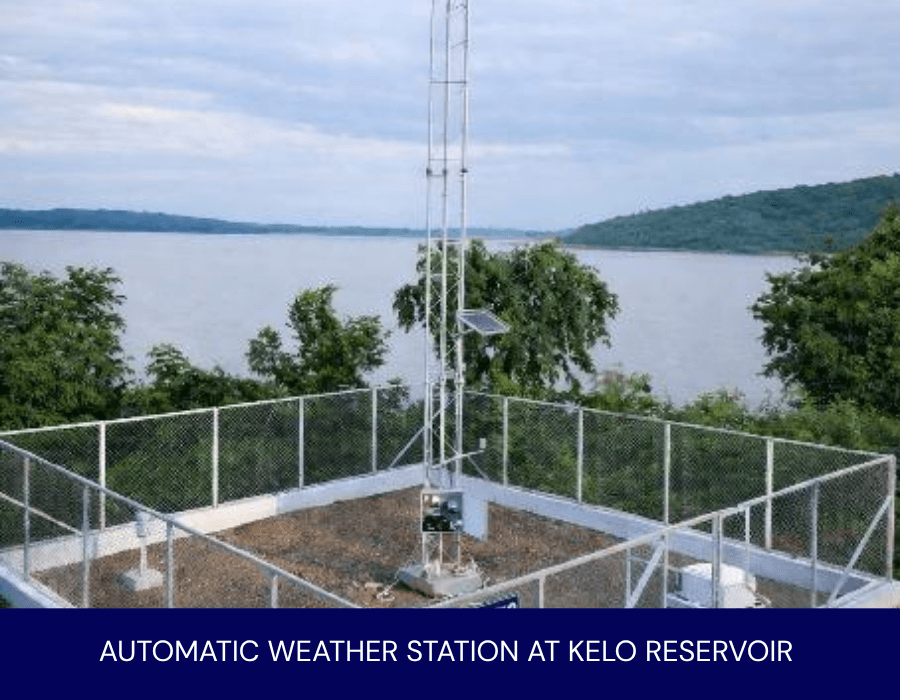
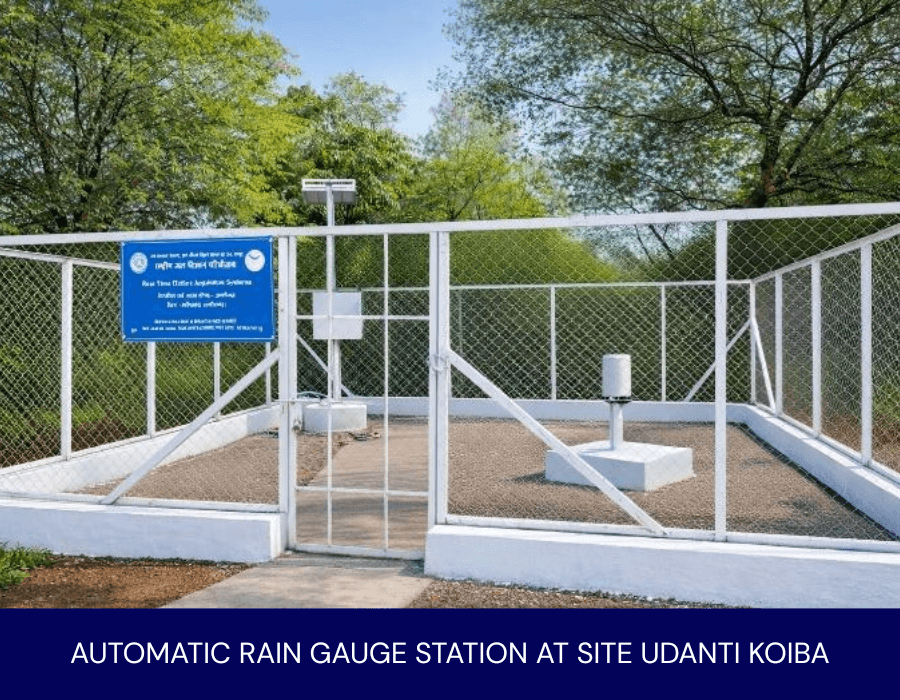
Aaxis deployed a carefully selected suite of RTDAS, combining advanced instrumentation and resilient infrastructure, telemetry and integrated analytics, purpose built for large-scale, long-term hydrological monitoring. Automatic Weather Station to measures 6 parameters, temperature, Relative humidity, wind speed, wind direction, atmospheric pressure and precipitation. Deployment of AWLRs1 , ARGs2 , ATRH Probe3 , Shaft Encoder4 , Evaporimeter5 and Pyranometer6 .
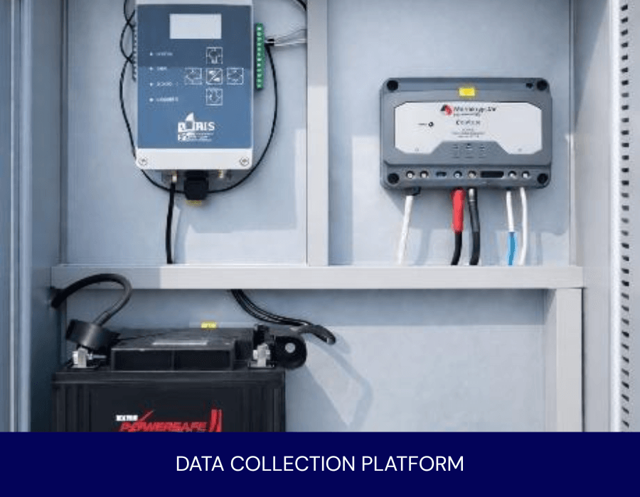
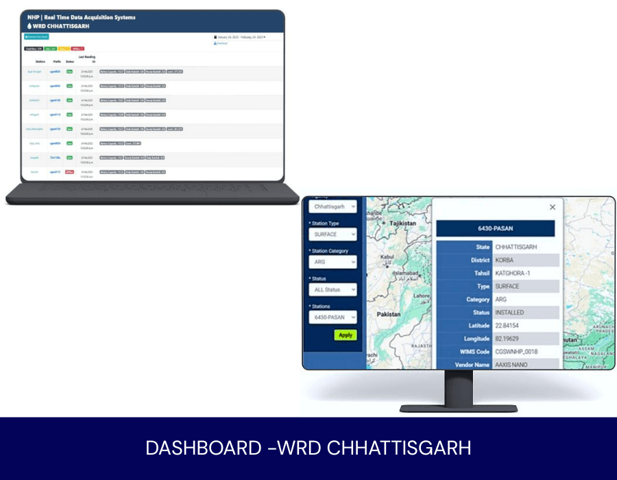
Secure GSM/GPRS and INSAT- based communication to ensured uninterrupted data transmission from remote, unattended sites. Integrated Software and Analytics Platform, interfaced with WRD’s e-SWIS , enabling configuration, calibration, validation and realtime visualization at the state data centre .
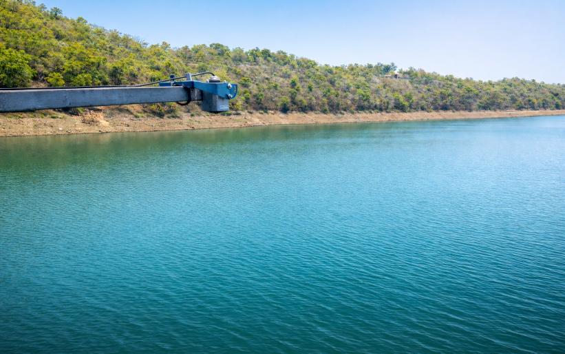
Chhattisgarh is drained by 4 major river systemsGanga, Mahanadi, Narmada and Godavari with total flood-affected area estimated at 12,029 hectares. To address the technical requirements, the WRD partnered with Aaxis Nano to implement a statewide a Real-Time Data Acquisition System, delivering a 360o monitoring solution across 160 strategic locations spanning the Mahanadi, Godavari , Ganga and Brahmani River basins.
Redefined Operational Control
Delivered on time with WRDcertification, the project translated complexity into clarity, enabling statewide Real-time monitoring. The project transformed intricate hydrological data into lucid insights. Continuous real-time analysis enhanced flood preparedness, refined river and reservoir management, and guided geological planning, while automated systems bridged gaps and minimized human errors, empowering governance that is informed, proactive and decisively risk-ready.
Aaxis Nano operates in dialogue with the environment, adapting to terrain, weather and ecology to honour its long-term responsibility. By unifying instrumentation, telemetry analytics and long-term stewardship, Aaxis Nano emerged not merely as a solution provider but as a strategic partner- strengthening Chhattisgarh’s water resilience.
- Automatic Water Level Recorders (AWLRs) -SOM-L30 by Sommer
- Automatic Rain Gauges (ARGs)- TB3 by Hyquest Solution
- ATRH Probe – RHT175 by Microstep- MIS
- Shaft Encoder- AD375MA by Hyquest Solutions
- Evaporimeter-Evap TSP by Microstep- MIS
- Pyranometer- SP Lite 2 by Hach OTT
Photo Gallery